English   Română   Español   Français   Deutsch  

getamap.net

Africa

Oceania

Asia

North America

Europe

South America

Antarctica


Lykke Peak

/ Bouvetoya (general)

54°26'12" S
3°19'15" E
~765m asl
( - UTC/GMT+)

Lykke Peak (Lykke Peak) is a peak (class T - Hypsographic) in Bouvetoya (general) (Bouvet Island (general)), Bouvet Island [ Norway ] (Antarctica) with the region font code of Americas/Western Europe. It is located at an elevation of 765 meters above sea level.
Lykke Peak is also known as Lykkes Topp, Lykketoppen.

Its coordinates are 54°26'12" S and 3°19'15" E in DMS (Degrees Minutes Seconds) or -54.4367 and 3.32083 (in decimal degrees). Its UTM position is EV26 and its Joint Operation Graphics reference is SN31-08.

Current local time is ; the sun rises at 08:54 and sets at 21:01 local time ( UTC/GMT+). The standard time zone for Lykke Peak is UTC/GMT+
In 2024 DST starts on - and ends on -.

A Peak is a pointed elevation atop a mountain, ridge, or other hypsographic feature.


Country
 Advertisements:


 Advertisements:


Weather Lykke Peak (Cloud cover, Temperature, Wind speed and Precipitation mm probab.)

Fri


Apr 26
Clound 0-100-100-100 Mist
~1 l/m2 61%
 
1 cm (Snow)
-3 °C min
-1 °C max
44 km/h
Thu Jan 1

Sat


Apr 27
Clound 10-50-40-50 Mist
~1 l/m2 56%
 
-5 °C min
-1 °C max
54 km/h
Thu Jan 1

Sun


Apr 28
Clound 0-50-0-0 Mist
 
-5 °C min
-3 °C max
34 km/h
Thu Jan 1

Mon


Apr 29
Clound 0-100-0-0 Mist
 
-5 °C min
-3 °C max
39 km/h
Thu Jan 1

Tue


Apr 30
Clound 0-30-20-80 Mist
 
-5 °C min
-4 °C max
38 km/h
Thu Jan 1

Wed


May 1
Clound 0-60-80-100 Mist
 
-5 °C min
-3 °C max
34 km/h
Thu Jan 1

Weather Graph

Lykke Peak (Bouvetoya (general)) 7 day forecast
 

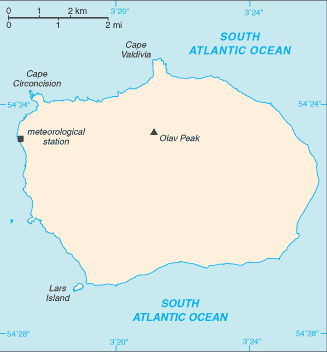
Map and Photos Lykke Peak


Comments

--- There are no comments yet ---


Add a new comment:


You have to log in to add a comment!


Members area


Register

Forgot password?

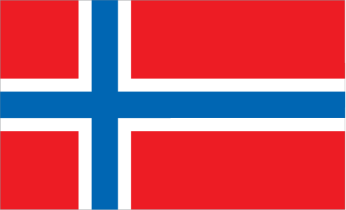
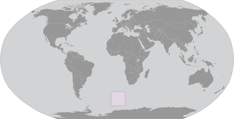
Bouvet Island [ Norway ] (Norway):

Advertisement


GPS points near Lykke Peak


square Benn Skerries (1 km)

square Bennskjaer (1 km)

square Bennskjaeret (1 km)

square Rustad Knoll (1 km)

square Rustadkollen (1 km)

square Catoodden (1 km)

square Cato Point (1 km)

square Seal Point (1 km)

square Bolle Bay (1 km)

square Bollevika (1 km)

square Mosby Peak (1 km)

square Mosbys Topp (1 km)

square Mosbytoppen (1 km)

square Lars Island (1 km)

square Lars Islet (1 km)


GPS points from Bouvet Island [ Norway ] (Norway)

square Cape Circoncision Bouvetoya (general)

square Devil's Gate Bouvetoya (general)

square Motte Sound Bouvetoya (general)

square Bouvet Island Bouvetoya (general)

square Engelbrechtbreen Bouvetoya (general)

square Posadowskybreen Bouvetoya (general)

square Vogt Coast Bouvetoya (general)

square Kaap Meteor Bouvetoya (general)


viewweather.com sv.ViewWeather.com
fr.ViewWeather.com
da.ViewWeather.com
de.ViewWeather.com
es.ViewWeather.com
www.carpati.org
www.searchromania.net
Deblocari usi
es.getamap.org
fr.getamap.org
de.getamap.org
nl.getamap.org
da.getamap.org
www.getamap.org
Links
Terms of use
Privacy policy

# 0.0622 sec 

contact AT getamap.net

© 2006 - 2024  https://www.getamap.net/